The GIS Program participates in many different kinds of projects for CTUIR. Here are some of our active and completed projects.
Climate Change Protection
The GIS Program has participated in two climate change funding opportunities under the BIA. The first opportunity was in 2014 and funded CTUIR to develop a web portal consolidating climate data for CTUIR with the purpose of providing data to inform planning efforts for climate change impacts. The results of this effort included incorporating 31 datasets in the data library. The data are accessible through the climate change story map.
The second effort has funded CTUIR to predict changes to the Umatilla river floodplain based on anticipated climate driven variables. This effort was funded in 2017 and is on track for completion in 2019. Please check out this quad report for more information FutureFlowsQuadReport_July2017
Natural Resource Management – Channel Classification and Floodplain Morphology
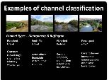
Quantitative measures linking process-based, physical habitat characteristics to salmonid utilization remains a central problem plaguing Pacific Salmon recovery efforts and sub-basin plans (NWPCC 2005) throughout the Columbia River basin. Multiple river classification systems developed to better monitor, manage and characterize river ecosystems (Hudson et al. 1992, Maxwell et al. 1995, Montgomery 1995, Poff 1997). In order to provide a more efficient and objective assessments of riverine conditions we develop a characterization of physical processes and classify salmon utilization among and between these habitats.
We take an approach that complements past efforts, specifically the Environmental Diagnosis and Treatment (EDT) techniques, by using extensive digital datasets and physical models to predict coarse scale, potential habitat conditions for several watersheds. Our approach classifies all stream segments in these watersheds using techniques developed from physical and statistical models. We model spatially extensive physical processes using existing 10 meter DEMs and 1:24,000 scale stream data sets that provide continuous values for several important hydrologic and geomorphic parameters. The resulting database of all stream classifications will be used to inform our restoration efforts.