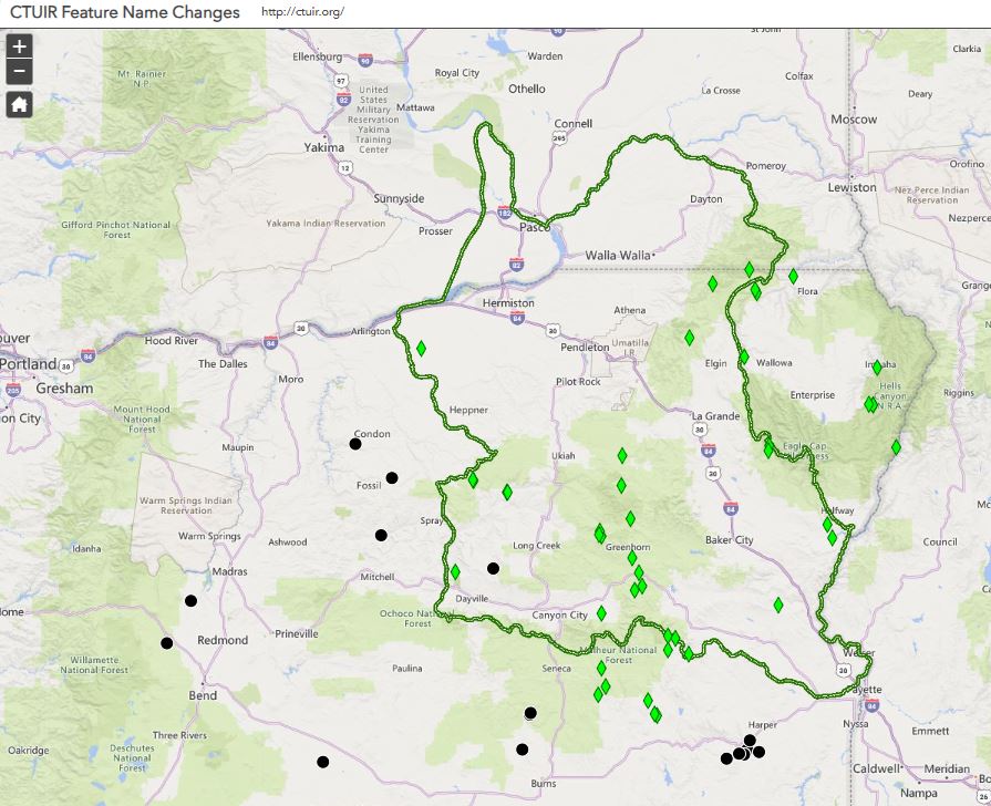
View current air quality numbers and projected values for tomorrow. Use the legend to turn data layers on and off. Data is pulling from the US EPA feature layer updated hourly and reflects the latest hour of air quality data received from monitoring sites that report to AirNow.
Feature Layer by OAR_OAQPS_EPA.
The Climate Data story map was created to centralize available data and provide Tribal Government easy access to information to inform management concerns. This application contains 13 sections of climate data and information, including 30 web maps.
CTUIR hunting licenses are required for hunting on Tribal fee and trust lands and individual Indian allotments within the reservation. Property boundaries may not be marked and it is the responsibility of the hunter to be aware of the properties they are hunting on. It is the hunters responsibility to obtain land owner permission to access or cross properties for the purpose of hunting. Purchase of the license grants permission to hunt upland birds and waterfowl on Tribally owned lands but does not secure access to travel across private individual land or allotments.
The Kentch Project is a river restoration project in the Walla Walla Basin (WA). This interactive web tool lets you scroll through the project to learn more.
This is a web mapping application to identify road ownership within the Umatilla Indian Reservation. No warranty is made for this information beyond the purpose intended by CTUIR staff.
Stream flow modeling effort in the Umatilla River predicts an increase in flow variability, resulting in a likely increase in average winter stream flow and complex, varied responses for summer flows.